Sun, May 27, 2012, 4:00 am: Christiansted Fort to Frederiksted Fort Scenic Route Hike
General info for all hikes and walks: Hikes and walks are $5 for members, and $10 for non-members (become a member). Unless otherwise noted, the pace for hikes is moderate, lasting 3-5 hours, covering 3-5 miles, the terrain is hilly, footing is sometimes uneven, and we follow trails and possibly paved or dirt roads . Walks are easier and shorter than hikes, and usually follow paved or dirt roads, no trails. The guide may periodically stop and talk along the way. Bring sturdy, comfortable walking or hiking shoes, water, snack, bug spray, rain poncho, and camera. Shorts or long pants are OK. For day hikes, bring a hat and sun block. For night hikes, bring a small flashlight. There are usually about 20 people. We depart about 30 minutes after the posted start time. For some hikes, we will meet at the indicated location, then drive a short distance to the hike location.
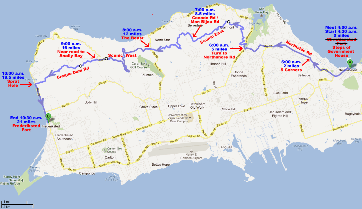
Specific info for this hike: New Start Location! Meet at 4am at Christiansted Fort the steps of Government House on King Street, Christiansted. We will walk out of town via Golden Rock, 5 Corners, down Morning Star hill, right towards Salt River, to Scenic East, to Scenic West, Creque Dam Rd, Sprat Hall, ending at Frederiksted Fort. The route is 21 miles total, and will take about 6 hours. Join us along the way if you don't want to walk the entire route. Some vehicles will be waiting in Frederiksted for the return trip.
See route diagram below or go to Google Maps where you can zoom in.
Route diagram below assumes that we start walking at 4:30am at an average speed of 3.5 miles per hour. Times shown are approximate. If you want to meet us along the way, please arrive before the times shown, to be sure not to miss us.
St. Croix Hiking Association - home page